
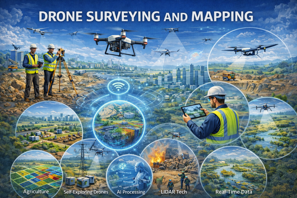
LAND MAPPING AND SURVEY
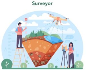
Land surveying involves measuring land to determine its boundaries, shape, and features. This includes buildings, roads, slopes, water bodies, and other natural or man-made elements.
Land mapping takes this measured data and converts it into maps and digital models that are easy to read and use. These maps help planners, engineers, and landowners understand exactly what the land looks like and how it can be used.
At Skyx, land mapping and survey services are designed to provide clear, accurate information using modern technology and professional expertise.
UNDERSTANDING DRONE SURVEYING AND MAPPING
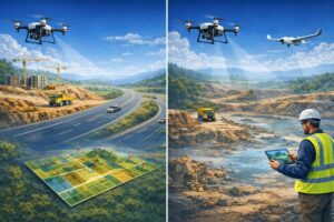
Drone surveying and mapping have changed the way land and infrastructure projects are planned and executed. By using unmanned aerial vehicles (UAVs) equipped with high-resolution sensors, large areas can be surveyed quickly, safely, and with high accuracy. This approach is now widely used across construction, real estate, infrastructure, mining, and urban planning.
At Skyx, drone-based surveying and mapping solutions combine advanced technology with professional expertise to deliver reliable geospatial data for better decision-making.
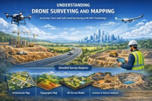
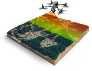
Drone mapping converts the collected data into outputs such as:
- Orthomosaic maps
- Topographic maps
- Digital surface and terrain models
- Contour maps and volumetric calculations
These outputs provide a detailed view of the land without the need for extensive ground-based surveys.
KEY BENEFITS OF DRONE SURVEYING AND MAPPING
Drone surveying and mapping offer a modern approach to capturing accurate land and infrastructure data. Compared to traditional survey methods, drones provide faster results, improved safety, and better data quality.
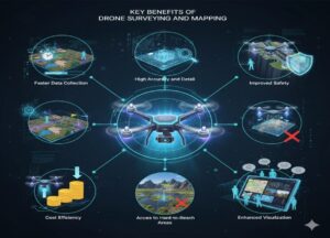
- Faster Data Collection – Drones can survey large areas in a short time. What may take days using conventional methods can often be completed in a few hours, helping projects move forward without delays.
- High Accuracy and Detail – High-resolution cameras and advanced processing software produce precise maps, contours, and 3D models. When supported by ground control points, drone surveys can achieve survey-grade accuracy.
- Improved Safety – Drone surveying reduces the need for personnel to work in difficult or hazardous environments such as steep terrain, traffic corridors, or active construction sites.
- Cost Efficiency – With fewer field hours and reduced manpower, drone surveys often lower overall project costs while delivering faster turnaround times.
- Access to Hard-to-Reach Areas – Drones can easily capture data from locations that are difficult or unsafe to access on foot, including uneven terrain, waterlogged areas, and large open sites.
- Enhanced Visualization – Aerial imagery, orthomosaic maps, and 3D models provide a clear visual understanding of the site. This helps stakeholders review, plan, and communicate more effectively.
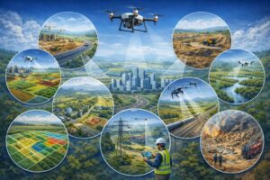
APPLICATIONS OF DRONE MAPPING ACROSS INDUSTRIES
Drone mapping is widely used to capture accurate aerial data for faster planning and better decision-making.
- Construction and Infrastructure: Site planning, progress tracking, and measurement verification
- Real Estate and Land Development: Land assessment, layout planning, and visualization
- Mining and Quarrying: Volume calculations and site monitoring
- Agriculture: Crop health analysis and irrigation planning
- Urban Planning: Infrastructure mapping and smart city development
- Utilities and Power: Inspection of power lines, pipelines, and corridors
- Environmental Management: Mapping water bodies, drainage, and sensitive areas
- Disaster Management: Rapid damage assessment and emergency response
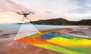
DRONES AS A REMOTE SENSING TOOL: TYPES OF SENSORS USED
Drones are powerful remote sensing platforms that can carry a variety of sensors to capture data beyond what the human eye can see. Different sensors provide different types of information, making drones versatile tools for surveying, mapping, and monitoring.
- RGB (Red-Green-Blue) Cameras – Standard high-resolution cameras capture visual imagery for creating orthomosaic maps, 3D models, and site inspections. They are widely used in construction, real estate, and land surveying.
- Multispectral Sensors – These sensors capture light beyond visible wavelengths, helping assess vegetation health, crop conditions, and land cover. Commonly used in agriculture and environmental monitoring.
- LiDAR (Light Detection and Ranging) – LiDAR sensors use laser pulses to measure distances, generating highly accurate 3D point clouds and terrain models. Ideal for dense vegetation, forestry, and complex topography.
- Thermal Cameras – Thermal sensors detect heat signatures, useful for monitoring energy efficiency, detecting water stress in crops, or inspecting industrial infrastructure.
- Hyperspectral Sensors – Hyperspectral sensors capture hundreds of narrow wavelength bands, providing detailed information on material composition, vegetation stress, and environmental monitoring.
- GNSS/GPS Receivers – These sensors provide precise positioning and georeferencing of data, essential for survey-grade mapping and integrating drone data with GIS systems.
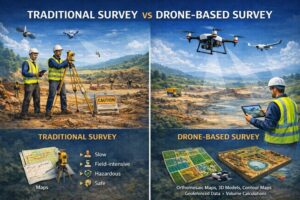
TRADITIONAL SURVEY VS DRONE-BASED SURVEY
Traditional surveying relies on manual measurements using tools like total stations, theodolites, and GPS. While accurate, it is time-consuming, labor-intensive, and sometimes risky in difficult or hazardous terrain.
Drone-based surveying, on the other hand, collects data from the air using cameras, LiDAR, and other sensors. It is much faster, safer, and cost-effective, especially for large or complex areas. Drones can produce high-resolution maps, 3D models, and volume calculations, and surveys can be easily repeated for monitoring or updates. In short, drones complement traditional methods by making surveying more efficient, visual, and accessible for modern projects.
Traditional surveying is reliable for small, precise areas but can be slow and labor-intensive. Drone-based surveying offers faster data collection, improved safety, and enhanced visualization for large and complex projects, making it ideal for modern land mapping and infrastructure planning.
FUTURE TRENDS IN DRONE SURVEYING AND MAPPING
Drone surveying and mapping are advancing rapidly with improvements in technology and data processing. The growing use of AI and automation is speeding up data analysis and reducing manual effort, while drone-based LiDAR is becoming more common for mapping complex terrain and dense vegetation. Real-time and faster data processing are enabling quicker on-site decisions, supported by higher accuracy through RTK and PPK positioning systems. At the same time, better integration with GIS platforms and digital twin models is expanding long-term planning and asset management capabilities, while evolving regulations are driving wider industry adoption.